Latest activity and alert level
Check the live status hub
Sakurajima is persistently active and conditions can change quickly. View the Volcoholics volcano directory for the latest verified official position from the Japan Meteorological Agency.
View latest Sakurajima status →Kagoshima · Japan’s restless ash volcano
Sakurajima
A highly active stratovolcano rising from Kagoshima Bay—famous for frequent Vulcanian explosions, ashfall and its place inside the vast Aira Caldera.
Scroll across the bay ↓
Chapter one
Japan’s ash-making volcano
Sakurajima sits only a few kilometres across Kagoshima Bay from a major city, making every explosion part of daily life for residents, ferry passengers and visitors.
The volcano is a post-caldera cone growing inside the Aira Caldera. Its modern summit complex includes Kitadake, Minamidake and the Showa crater area. Activity is currently centred on Minamidake and Showa, where explosive eruptions can produce ash plumes, ballistic blocks and strong air shocks.
Sakurajima was once an island. Lava from the 1914 Taishō eruption crossed the narrow strait on its eastern side and permanently connected it to the Ōsumi Peninsula.
JMA’s alert system translates monitoring into practical restrictions. official monitoring means people must not approach the volcano, while communities farther away prepare for ashfall, small wind-blown fragments and potential debris flows during heavy rain.
1,117 mElevation
official monitoringofficial monitoring
1914Taishō eruption
JMAOfficial monitoring
Sakurajima quick facts
- Volcano type
- Post-caldera stratovolcano
- Location
- Kagoshima Bay, Japan
- Elevation
- 1,117 metres
- Modern activity
- Persistent since 1955
- Official agency
- Japan Meteorological Agency
Activity and behaviour
Frequent explosions from an open volcanic system
Evergreen profile
How Sakurajima behaves
Sakurajima commonly produces ash-rich explosions, incandescent ballistic fragments, volcanic lightning and repeated crater activity. Ashfall can affect Kagoshima even when activity remains confined to the summit area.
Check the latest verified status →Characteristic activityExplosive eruptionsFrequent ash-rich bursts and crater explosions
Main active craterMinamidakePersistent activity has focused here in recent decades
Proximal hazardBallistic fragmentsDanger is greatest close to the crater
Regional hazardAshfallKagoshima is frequently affected downwind
Official sourceJMAAuthoritative alerts, observations and guidance
Signature chapter
Explosions written in ash
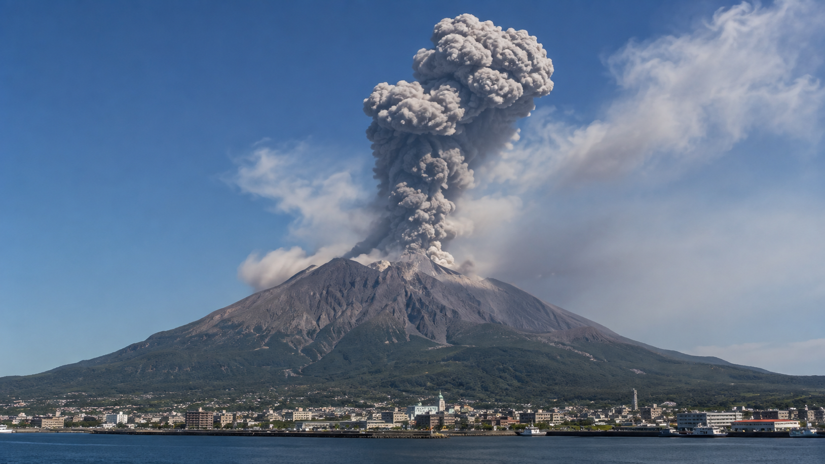
Sakurajima is best known for short, sharp Vulcanian explosions that blast ash, gas and blocks from the crater.
Pressure builds beneath a temporarily obstructed vent until gas fragments the magma and clears the pathway. The result may be a dark ash plume, a sudden air shock and large ballistic blocks around the crater.
Wind determines where ash travels. Kagoshima residents often check forecasts not only for rain and temperature, but also for the expected direction of volcanic ash.
How to read official updates
Reading a Sakurajima bulletin
JMA reports describe more than whether an explosion happened. They show how energetic it was, where the ash travelled and whether near-crater hazards increased.
Chapter three
How Sakurajima works
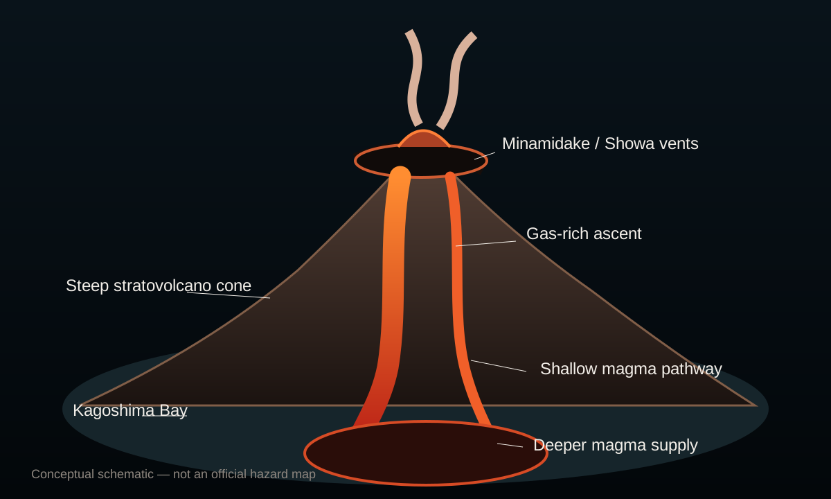
Subduction supplies magmaThe Philippine Sea Plate descends beneath southwest Japan, supporting magma generation.
Magma moves beneath AiraLong-term deformation indicates magma accumulation within the broader caldera system.
Gas pressure buildsGas-rich magma and temporary vent blockage help produce Vulcanian explosions.
Multiple craters respondMinamidake summit crater and Showa crater have both produced modern activity.
Ash and rain create new hazardsLoose deposits can be remobilised into debris flows during heavy rainfall.
Chapter four
A cone inside a giant caldera
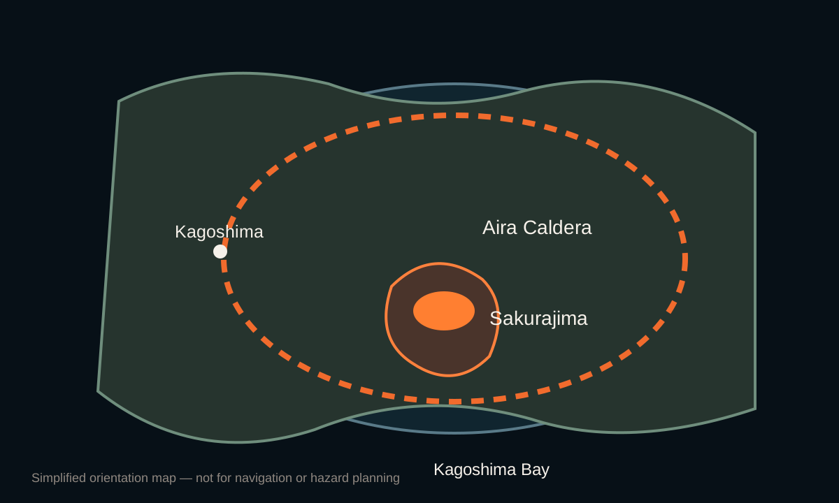
Sakurajima is only the most visible part of a much larger volcanic system beneath northern Kagoshima Bay.
Aira Caldera formed during a huge eruption about 22,000 years ago. Sakurajima grew later near the caldera’s southern rim, building a composite volcano above the bay.
Ground deformation across the region helps scientists estimate magma accumulation beneath the broader system. That does not mean a caldera-forming eruption is imminent; it means Sakurajima must be interpreted as part of Aira rather than as an isolated cone.

Chapter five
Watching every explosion across the bay
JMA, the Kagoshima Local Meteorological Office and research institutions use dense monitoring because frequent background activity must be separated from genuine escalation.
Seismicity and tremorTrack earthquakes, magma movement and explosion signals beneath the volcano.
InfrasoundMeasures the pressure waves generated by explosive eruptions.
GNSS and tiltRecord deformation across Sakurajima and the wider Aira Caldera.
Cameras and thermal dataFollow plume height, glow, ballistic ejecta and weather conditions.
SO₂ measurementsHelp describe magma degassing and changes in eruptive output.
Ash forecastingSupports aviation and daily preparation in downwind communities.
A volcano through time
Sakurajima eruption timeline
1471–76
Bunmei eruption
A major eruptive period produced lava flows and deposits around the older volcano.
1779–82
An’ei eruption
Large explosive and effusive activity affected the island and surrounding sea.
1914
The Taishō eruption
One of Japan’s largest twentieth-century eruptions produced powerful earthquakes, ash and lava that joined Sakurajima to Kyushu.
1946
Shōwa lava eruption
Lava flowed from the eastern flank and helped form the crater later known as Showa.
1955–
Persistent Minamidake activity
Frequent explosive eruptions established Sakurajima’s modern reputation as one of Japan’s most active volcanoes.
2006–18
Showa crater reactivates
Thousands of explosions occurred from Showa crater during a highly active modern phase.
latest official activity2026
official monitoring and persistent explosive activity
JMA continues official monitoring restrictions while Minamidake and Showa crater remain capable of ash-rich explosions, ballistic ejecta and small pyroclastic flows near the crater.
What threatens people and infrastructure
Sakurajima's main hazards
☁
Ashfall
Frequent ash affects roads, homes, machinery, agriculture, health and aviation across Kagoshima Bay.
✹
Ballistic blocks
Large fragments can be thrown around active craters during stronger explosions and define the immediate exclusion zone.
≋
Pyroclastic flows
Small, fast-moving flows may accompany stronger eruptions and threaten near-crater areas.
≈
Debris flows
Heavy rain can remobilise ash and volcanic sediment into dangerous channelised flows.
Volcoholics InsightSakurajima's risk is cumulative: routine ash clean-up and transport disruption sit alongside the less frequent possibility of much larger explosive activity.
Myths and reality
Sakurajima myths, separated from the science
Frequent explosions mean every day is an emergency.
Reality: persistent activity is expected, but JMA watches closely for changes that would alter restrictions or community risk.
Ash only affects the volcano itself.
Reality: wind can carry ash across Kagoshima Bay, affecting urban life, transport, health and aviation.
Sakurajima is separate from Aira Caldera.
Reality: the cone sits on the southern edge of a much larger volcanic system beneath northern Kagoshima Bay.
official monitoring means a major eruption is imminent.
Reality: official monitoring sets practical near-volcano restrictions; it is not a countdown to a catastrophic eruption.
Volcoholics Insight
The volcano across the water
“Sakurajima is extraordinary because an active explosive volcano and a modern city watch one another across the bay. Its frequent ash may feel routine, but every plume is part of a much larger and deeply monitored volcanic system.”
This editorial summary is based on the scientific information presented above. It does not replace official monitoring or public-safety guidance from JMA, Kagoshima authorities or Japanese emergency services.
Frequently asked questions
Sakurajima explained
What is Sakurajima’s official monitoring level?
JMA currently lists Sakurajima at official monitoring: do not approach the volcano.
Is Sakurajima erupting?
It remains an active eruptive system capable of frequent ash emissions and explosive eruptions.
Which craters are active?
Modern activity is associated mainly with Minamidake summit crater and Showa crater.
Why is Kagoshima often covered in ash?
Fine ash from frequent explosions is carried across the bay when winds blow towards the city.
Is Sakurajima still an island?
No. Lava from the 1914 eruption connected it permanently to the Ōsumi Peninsula.
How high is Sakurajima?
The Smithsonian Global Volcanism Program lists an elevation of 1,117 metres.
What does official monitoring mean?
It means people must not approach the volcano and near-crater restrictions are in force.
Who monitors Sakurajima?
JMA leads official monitoring, supported by the Kagoshima Local Meteorological Office and research institutions.
What is Aira Caldera?
It is the large caldera beneath northern Kagoshima Bay within which Sakurajima later formed.
Can Sakurajima produce pyroclastic flows?
Yes. JMA warns that small pyroclastic flows can accompany eruptions close to the active craters.
What happened in 1914?
The Taishō eruption produced major ashfall, earthquakes and lava flows that joined the island to Kyushu.
Where are official updates published?
Use JMA’s volcanic warning and Sakurajima activity pages.
About this profile
Official science, made readable
Volcoholics Atlas chapters use official observatory publications, civil-protection information and authoritative eruption records. Editorial passages explain why the observations matter while keeping official monitoring and safety guidance clearly separate.
Japan Meteorological AgencyOfficial warning level, activity information and volcanic ash forecasts.
Kagoshima Local Meteorological OfficeRegional monitoring and Sakurajima activity information.
Smithsonian Global Volcanism ProgramGeological history and international eruption record.