No eruption in progress; observatory monitoring and access rules remain active.
Volcano profile · La Réunion
Piton de la
Fournaise
One of the world's most active basaltic shield volcanoes — a fast-moving fissure system contained, much of the time, inside the vast Enclos Fouqué.
Latest activity and alert level
Check the live status hub
Piton de la Fournaise can shift rapidly between quiet intervals, magma intrusions and fissure eruptions. View the Volcoholics volcano directory for the latest verified official position from OVPF–IPGP.
View latest Piton de la Fournaise status →The living shield
La Réunion's living shield
Piton de la Fournaise occupies the south-east of La Réunion and ranks among Earth's most frequently erupting volcanoes.
Its broad basaltic shield is built by repeated fissure eruptions. Many begin inside the Enclos Fouqué, a large horseshoe-shaped depression open toward the east. This natural topography contains many lava flows, but it does not remove the need for close monitoring or strict access control.
Activity can accelerate quickly. A short seismic crisis may mark magma leaving the shallow summit reservoir, followed by ground cracking and fissure opening within hours.
2,632 mElevation
Shield volcanoVolcano type
Enclos FouquéMain eruptive area
OVPF-IPGPOfficial observatory
Piton quick facts
- Volcano type
- Basaltic shield volcano
- Location
- La Réunion, France
- Main crater
- Dolomieu
- Main enclosure
- Enclos Fouqué
- Monitoring
- OVPF-IPGP
Activity and behaviour
Frequent fissure eruptions inside a vast collapse caldera
Evergreen profile
How Piton de la Fournaise behaves
The volcano commonly produces basaltic fissure eruptions, short-lived lava fountains and extensive flows. Most activity is confined within Enclos Fouqué, though magma intrusions and flank eruptions can occur elsewhere.
Check the latest verified status →Characteristic styleBasaltic fissure eruptionsFluid lava and short-lived fountains
Main eruptive settingEnclos FouquéA large horseshoe-shaped collapse caldera
Typical precursorsSeismicity and deformationIntrusions may develop quickly
Main hazardsLava and gasAccess restrictions can change rapidly
Official sourceOVPF–IPGPAuthoritative monitoring and access information
Réunion alert phases
What “Vigilance” means
The operational phase describes the action authorities expect. It is not a countdown to eruption.
Restrictions tighten as a seismic crisis or magma intrusion develops.
Civil-protection measures depend on the location and evolution of activity.
Cooling lava, unstable ground and gas may keep areas closed after activity stops.
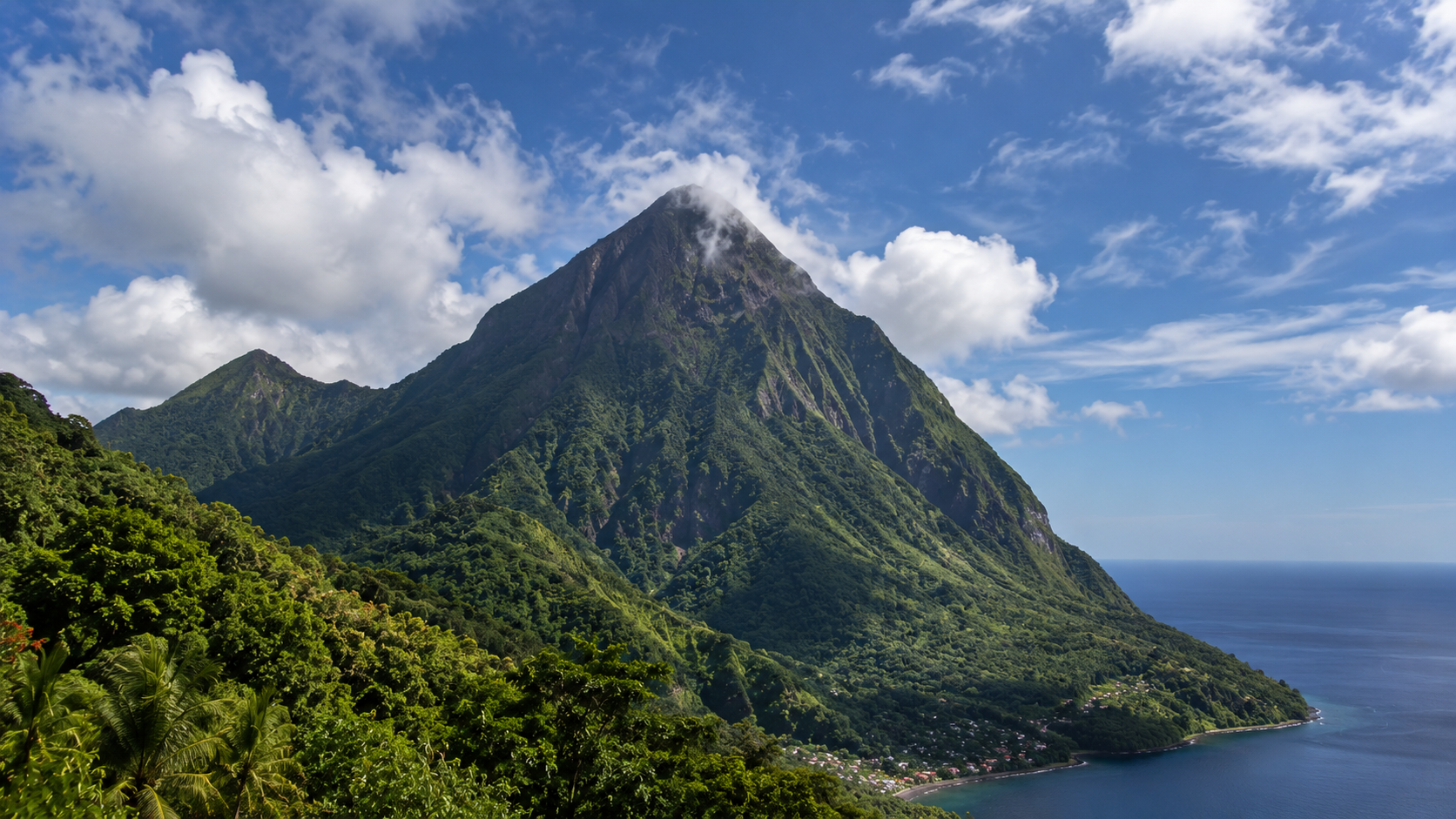
A volcano that builds an island
Fire, ocean and a growing shield
Repeated basaltic eruptions add new layers to the south-east of La Réunion. When lava reaches the coast, the island may grow — but the new land is unstable and ocean entry creates steam, acidic plumes and collapse hazards.
- Magma
- Basaltic and fluid
- Typical style
- Fissures and lava fountains
- Natural containment
- Often inside the Enclos
- Fast onset
- Possible after a short seismic crisis

Eruption sequence
From seismic crisis to glowing fissure
Piton can move from the first strong unrest to eruption quickly, so OVPF reads the sequence as a connected process rather than waiting for one decisive signal.
Inside the shield
How Piton de la Fournaise works
A shallow summit plumbing system feeds rift zones that repeatedly open across the upper shield.
Summit reservoirStores magma beneath Dolomieu and responds through inflation and deflation.
Dyke pathwaysCarry magma sideways and upward toward new fissures.
Rift zonesFocus repeated intrusion and eruption across the shield.
Basaltic magmaUsually favours lava fountains, channels and flows rather than sustained ash columns.


Natural containment
The Enclos Fouqué
The Enclos is central to how Piton's hazards are managed.
Its steep walls and eastward-opening shape contain many eruptions and guide lava toward the uninhabited Grand Brûlé. Yet eruptions outside the Enclos have occurred historically, and activity inside it can still close trails, threaten roads and create dangerous ocean-entry zones.
Contained does not mean harmless.Access restrictions remain essential during and after eruptions.

Monitoring
Watching a volcano that can accelerate quickly
OVPF-IPGP combines dense ground instruments, field teams and satellite observations because eruption onset may follow a short, intense seismic crisis.
Seismic networkTracks earthquakes, tremor and dyke intrusion.
GNSS and tiltMeasure slow recharge and rapid summit deformation.
Gas monitoringSO₂ and CO₂ help describe magma supply and degassing.
Webcams and thermal dataFollow fissures, fountains and lava channels.
SatellitesMap thermal anomalies, lava fields and broad deformation.
Field teamsSample lava, map cracks and maintain instruments.
A volcano through time
Piton de la Fournaise eruption timeline
17th–18th c.
Early documented eruptions
Historical accounts establish a long record of frequent activity on the young shield.
1977
Piton Sainte-Rose threatened
Lava left the Enclos and reached the coast, damaging buildings and entering the church grounds.
1986
Flows reach the sea
A major coastal eruption enlarged the island and demonstrated the hazards of ocean entry.
2007
Dolomieu collapse
A major eruption drained the summit system and triggered collapse of the Dolomieu crater floor.
2018–23
Frequent eruptive period
Repeated fissure eruptions rebuilt cones and lava fields across the Enclos.
Latest eruption1–20 Jan 2026
New Year fissure eruption
A seismic crisis on 1 January led to fissure activity inside the Enclos. The eruption continued until 20 January and produced a new lava field.
2026
Vigilance and controlled access
Routine monitoring continues while access is managed through prefectural restrictions and partial reopenings.
What matters most
Piton's main hazards
↘
Lava flows
Fluid basalt can cut roads, damage buildings, cross the Grand Brûlé and enter the ocean.
⌁
Fissures and unstable ground
Cracks, collapses and hot ground can appear rapidly near active or recent vents.
◇
Volcanic gas
SO₂ affects air quality close to vents and downwind during sustained activity.
≈
Ocean entry
Lava entering the sea creates unstable deltas, acidic plumes and steam explosions.
Volcoholics InsightThe Enclos contains many eruptions, but the hazard still depends on fissure location. A quiet summit can become operationally important within a short seismic crisis.
Myths and reality
Piton de la Fournaise myths, separated from the science
Most eruptions threaten towns.
Reality: many remain inside the Enclos, though historic activity outside it proves containment is not guaranteed.
Effusive means harmless.
Reality: lava, gas, fissures, unstable ground and ocean entry all create serious hazards.
Vigilance means eruption soon.
Reality: Vigilance is the normal operational monitoring phase, not an eruption countdown.
The danger ends when lava stops.
Reality: hot ground, unstable cones, gas and cooling lava can keep areas unsafe for much longer.
Volcoholics Insight
The furnace that builds an island
Piton de la Fournaise is unusually accessible and intensively monitored, but its rapid transitions demand respect. The volcano's basaltic eruptions often create spectacular lava rather than towering ash columns; the science lies in understanding how quickly the system can move from quiet recharge to a new fissure.
Questions answered
Piton de la Fournaise explained
Where can I find Piton de la Fournaise's latest official status?
Use the Volcoholics volcano directory for the latest verified summary, then follow OVPF–IPGP and local authorities for authoritative eruption, access and safety information.
What is the Enclos Fouqué?
A large horseshoe-shaped depression around the summit that contains and channels many eruptions toward the east.
What does Vigilance mean?
It is the normal monitoring phase used when no eruption is in progress; it is not a countdown to eruption.
How quickly can an eruption begin?
Piton can move from seismic crisis and intrusion to fissure opening quickly, which is why dense monitoring is essential.
Why is ocean entry dangerous?
New lava deltas can collapse, while hot lava meeting seawater creates steam, acidic plumes and local explosions.
Official science, made readable
Built from the agencies watching Piton
Operational status and access decisions belong to OVPF-IPGP and the Préfecture de La Réunion. Volcoholics translates those updates into clear context and never replaces official warnings.