Volcano profile · Colombia
Nevado del Ruiz
Kumanday
A glacier-clad Andean stratovolcano where even a moderate eruption can become a valley-scale disaster when hot volcanic material meets snow and ice.
Latest activity and alert levelCheck the live status hub
Nevado del Ruiz is continuously monitored by Colombia’s Servicio Geológico Colombiano. Use the Volcoholics directory for the latest verified operational status.
View latest Ruiz status →The northern giant of Los Nevados
An ice-capped volcano whose valleys can magnify an eruption
Nevado del Ruiz rises to about 5,321 metres in Colombia’s Central Cordillera and is an active composite stratovolcano capped by glacier ice.
The summit contains Arenas crater, the principal focus of modern eruptive activity. The crater is roughly one kilometre wide and about 240 metres deep.
Ruiz is famous not because its eruptions are always enormous, but because hot ash and rock can interact with snow and ice, generating lahars that are then channelled far down surrounding river valleys.
5,321 mSummit elevation
StratovolcanoVolcano type
Arenas craterActive summit vent
SGCOfficial monitoring
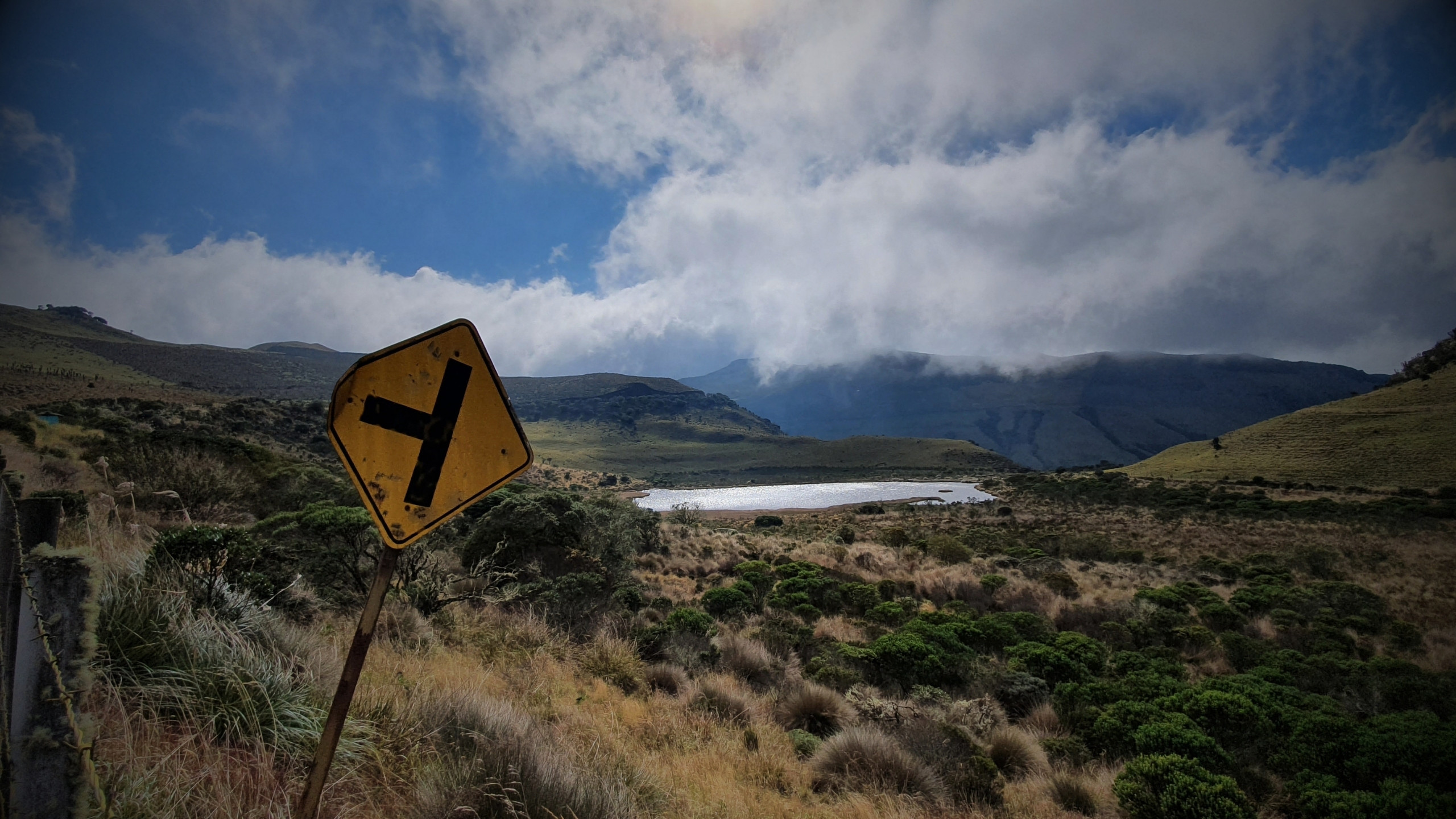
Nevado del Ruiz quick facts
- Region
- Central Cordillera
- Summit crater
- Arenas
- Crater width
- ~1 km
- Defining hazard
- Lahars
- Official agency
- SGC
Activity and behaviour
Explosive activity above ice-covered slopes
Evergreen profile
How Ruiz behaves
Nevado del Ruiz commonly produces ash emissions, gas release and explosive activity from Arenas crater. Its summit setting means even relatively modest eruptive heating can interact with glacier ice and snow.
Check the latest verified status →Active ventArenas craterModern activity is focused at the summit crater
Common productAshExplosive emissions can spread fine volcanic material downwind
Persistent signalVolcanic gasDegassing provides important evidence of magma beneath the summit
Amplifying factorGlacier iceHeat can rapidly produce meltwater during eruptions
Defining hazardLaharsValleys can carry volcanic debris many tens of kilometres
The lesson of Ruiz
The size of the disaster is not always the size of the eruption
The 1985 eruption was not among history’s largest explosive events. Its catastrophic consequences came from what happened next: hot eruptive material melted snow and ice, and water mixed with ash and sediment to form lahars that travelled far beyond the volcano.
Ice, water and topography
A summit eruption can become a river-valley catastrophe
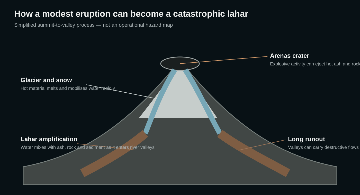
Ruiz’s glaciers and snowfields sit immediately around the active summit. During explosive activity, hot pyroclastic material can melt part of that ice and generate large volumes of water.
As the water moves downslope it mixes with ash, fragmented rock and sediment. Entrained within steep river valleys, these lahars can maintain destructive power far beyond the immediate volcanic cone.
Glacier capIce remains directly exposed to summit eruptive heat.
Arenas craterThe focus of modern explosive activity.
Drainage networkRivers connect the summit with distant lowland areas.
Lahar amplificationFlows gain water and sediment as they descend.
Monitoring after Armero
Modern surveillance watches the volcano and the valleys below it
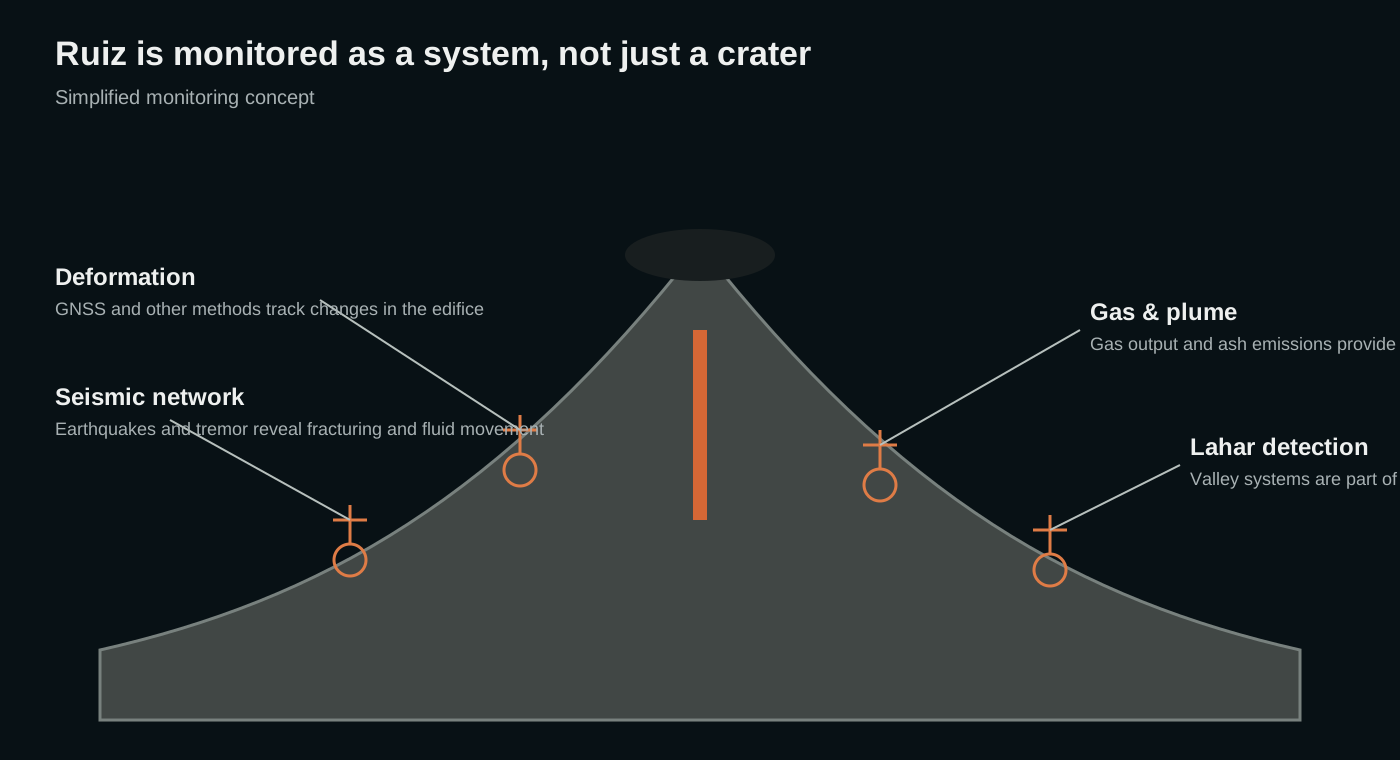
Colombia’s Servicio Geológico Colombiano monitors Nevado del Ruiz using seismic, geodetic, gas, visual and other observations. This network is a direct part of the scientific legacy of the 1985 disaster.
Monitoring today is not limited to identifying whether magma is moving. Understanding ash emissions, glacier conditions and possible lahar pathways is also essential to reducing risk downstream.
A multi-parameter volcano observatory
Watching seismicity, gas, deformation and surface change together
No single signal predicts an eruption. SGC combines several independent datasets to understand whether the system is changing and how those changes compare with its established behaviour.
A volcano through time
Nevado del Ruiz eruption timeline
Major historical eruption1595
Explosive eruption generates deadly lahars
A major historical eruption produced pyroclastic activity and lahars; more than 600 fatalities are recorded in historical accounts.
1845
Another destructive lahar episode
An eruption again generated lahars in valleys draining the volcano, demonstrating the recurrent nature of the hazard long before the twentieth century.
Armero disaster1985
A moderate eruption triggers catastrophic lahars
On 13 November, an explosive eruption melted summit ice and snow. Lahars travelled through several valleys and destroyed Armero, causing more than 20,000 deaths and becoming the defining modern lesson in volcanic risk at Ruiz.
1989
Phreatomagmatic eruption
An eruption on 1 September again demonstrated interaction between eruptive heat, water and the active summit system.
2012
Ash-producing eruptive activity
Episodes of elevated seismicity, gas release and ash emission marked renewed modern activity at Arenas crater.
21st century
Persistent unrest and intermittent ash emissions
The volcano has continued to produce periods of seismic unrest, strong gas output and intermittent ash emissions, reinforcing the importance of permanent monitoring.
Hazards
The hazards that matter most at Nevado del Ruiz
Water-rich volcanic debris can travel many tens of kilometres down established river valleys.
Fine ash can affect communities, agriculture, water supplies, roads and aviation.
Hot ash, gas and rock can sweep rapidly down the upper volcano.
Explosions can throw blocks around Arenas crater and the summit area.
Gas emissions can become hazardous around the crater and are an important monitoring signal.
Melting snow and ice can transform a summit eruption into a much larger downstream hazard.
Myths versus reality
Ruiz proves that eruption magnitude is only part of volcanic risk
The 1985 eruption was relatively moderate; the long-runout lahars created the catastrophic impact.
River valleys can connect distant settlements directly to hazards generated at the summit.
Less ice can reduce one water source, but snow, ice, rainfall and loose volcanic deposits still create significant lahar potential.
Volcoholics insight
Nevado del Ruiz changed how the world thinks about volcanic disasters
Armero showed that scientific hazard knowledge is only useful when monitoring, communication and emergency action connect all the way from the crater to the communities downstream. Ruiz remains a volcanic lesson written across an entire landscape: the eruption begins at the summit, but the disaster can unfold many kilometres away.
Questions answered
Nevado del Ruiz explained
What is the Arenas crater?
Arenas is the roughly one-kilometre-wide summit crater that forms the principal focus of modern activity at Nevado del Ruiz.
Why are lahars so dangerous at Ruiz?
Hot eruptive material can melt snow and glacier ice. The resulting water mixes with ash, rock and sediment and is channelled through river valleys far from the summit.
What happened at Armero in 1985?
Lahars generated by the 13 November eruption travelled down river valleys and devastated Armero and other communities, causing tens of thousands of deaths.
Who monitors Nevado del Ruiz?
Colombia’s Servicio Geológico Colombiano operates the official volcano-monitoring network.
Where can I find Ruiz’s current alert status?
Use the Volcoholics volcano directory for the latest verified summary and SGC for authoritative operational information.
Official science, made readable
Built from the agency watching Nevado del Ruiz
This evergreen profile uses Servicio Geológico Colombiano material as its principal scientific basis, supported by long-term Smithsonian Global Volcanism Program records. Permanent geology, eruption behaviour and hazards are kept separate from today’s changing operational status.
Servicio Geológico Colombiano (SGC)Official monitoring, hazard mapping, geological research and historical analysis of Nevado del Ruiz.
Smithsonian Global Volcanism ProgramLong-term eruption chronology, morphology and historical reference information.