Built by repeated lava flows, explosive eruptions and sector collapse.
Volcano profile · Washington, USA
Mount
Rainier
The highest volcano in the Cascade Range — a glacier-covered giant whose greatest threat can arrive as mud, rock and water racing through populated valleys.
Latest activity and alert level
Check the live status hub
Mount Rainier is continuously monitored and conditions can change over time. View the Volcoholics volcano directory for the latest verified official position from USGS Cascades Volcano Observatory.
View latest Mount Rainier status →A beautiful mountain with hidden power
Glaciers, weakened rock and crowded valleys
Mount Rainier is the highest volcanic peak in the contiguous United States and the most threatening volcano in the Cascade Range.
Its height, enormous glacier system, hydrothermally weakened rock and radial river valleys make it exceptionally capable of producing destructive lahars.
More than 90,000 people live in mapped lahar-hazard zones. Rainier therefore demands preparation even during long periods of quiet background activity.
4,392 mSummit elevation
Glaciated stratovolcanoVolcano type
Lahar hazardDefining hazard
USGS CVOOfficial monitoring
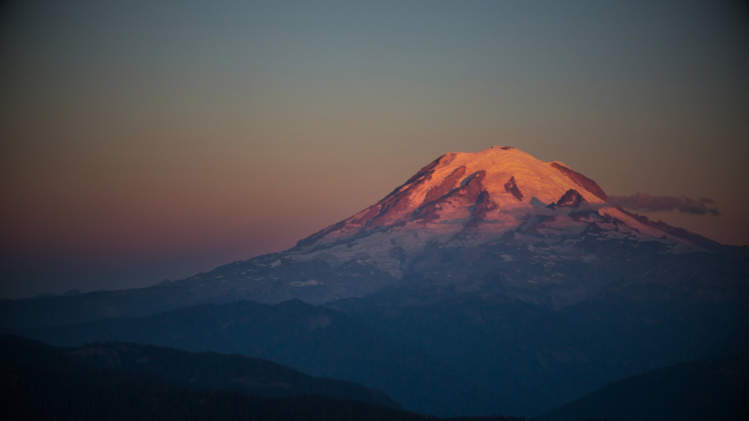
Rainier quick facts
- Volcano type
- Glaciated stratovolcano
- Summit elevation
- 4,392 metres
- Defining hazard
- Lahars
- Largest glacier
- Emmons by area
- Official agency
- USGS CVO
Activity and behaviour
The quiet giant of the Cascades
Mount Rainier is an active, glaciated stratovolcano whose defining hazard comes from the interaction of ice, water, weak rock and steep valleys.
Earthquakes, deformation, hydrothermal activity and glacier change are monitored continuously. Long quiet intervals do not remove the potential for lahars or renewed volcanic unrest.
Check the latest verified status →Mud, water and volcanic debris can travel far through river valleys.
The highest volcano in the Cascade Range.
Cascades Volcano Observatory provides authoritative monitoring and guidance.
Why Rainier matters
Rainier is one of the highest-risk volcanoes in the United States because large communities occupy valleys repeatedly used by past lahars.
Rainier's defining hazard
The mountain built from ice
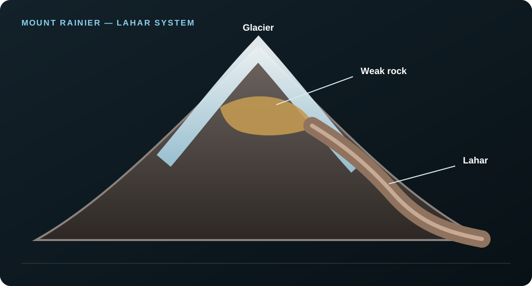
Rainier's glaciers, hydrothermally weakened rock and radial river valleys create a direct route from summit collapse to populated lowlands.
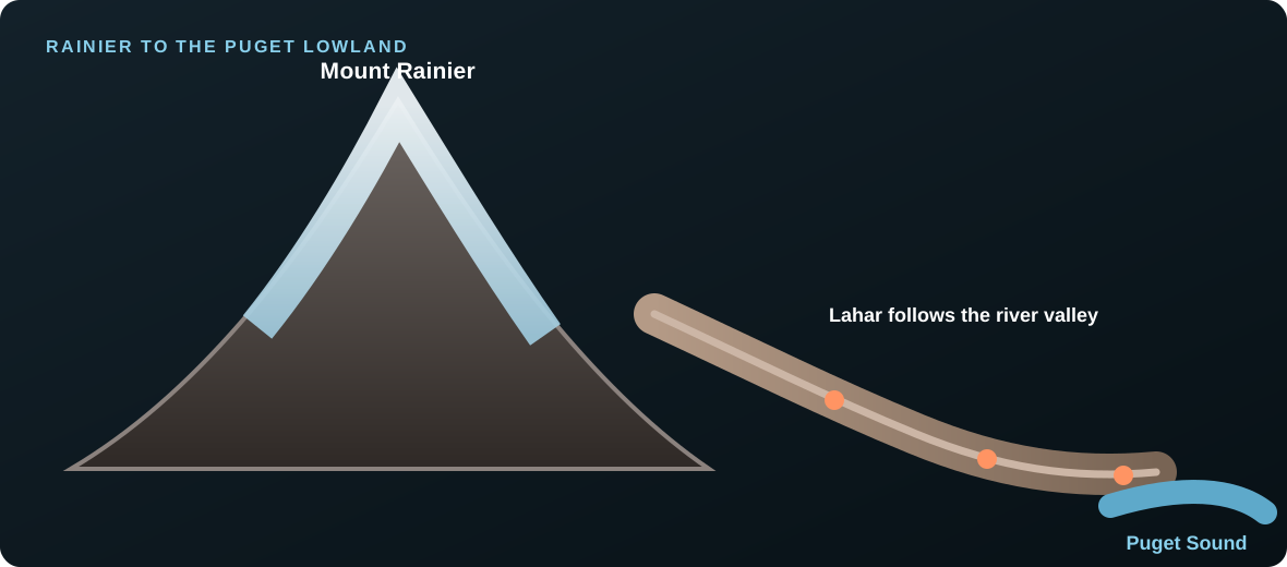
A lahar can begin with an eruption, melting ice, slope failure or sudden release of water and loose sediment. Once formed, it follows the mountain's river system far beyond the National Park.
GlaciersWater stored high on the cone.
Weak rockHydrothermal clay reduces slope strength.
ValleysNatural channels accelerate flow.
CommunitiesPrepared evacuation is essential.
Why lahars matter more than lava
Gravity turns the landscape into the hazard
Rainier's greatest threat is not a slow lava flow. It is the ability of ice, water and weakened volcanic rock to become a fast-moving lahar inside valleys that lead directly to towns.
Inside the volcano
How Mount Rainier works
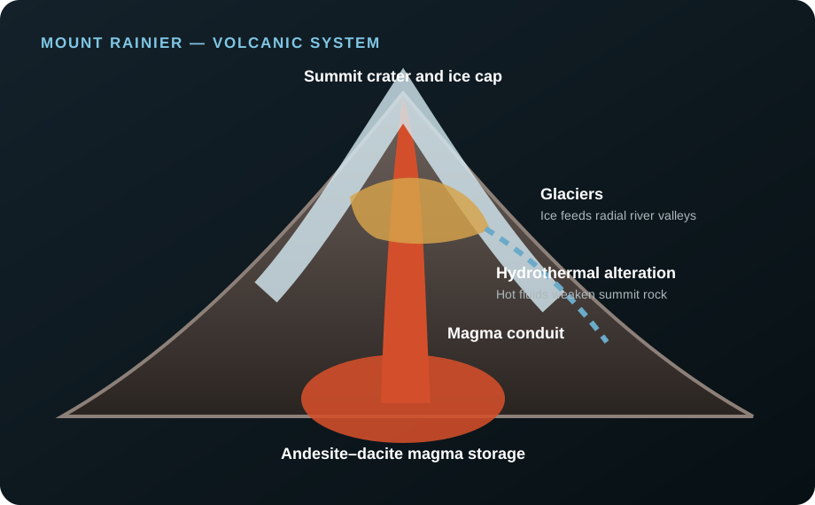
Rainier is both a volcanic system and a mountain-sized reservoir of ice and altered rock.
MagmaAndesite–dacite magma supplies explosive potential.
Hydrothermal systemHot fluids weaken rock beneath the summit.
GlaciersIce occupies deep valleys around the cone.
Radial riversValleys carry material toward lowlands.
Monitoring and warning
Watching the glaciers as much as the magma
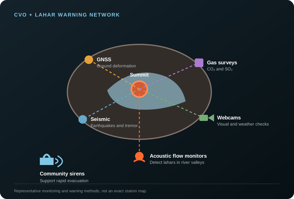
CVO combines volcano instruments with dedicated lahar detection and community warning systems.
Seismic networkTracks earthquakes and tremor.
GNSSMeasures ground deformation.
Gas surveysTrack volcanic emissions.
WebcamsWatch summit and weather conditions.
Acoustic flow monitorsDetect lahars in river valleys.
Sirens and drillsSupport fast community evacuation.
A volcano through time
Mount Rainier eruption and lahar timeline
~500,000 years
The ancestral volcano develops
Repeated lava flows and explosive eruptions build the large Cascade stratovolcano.
~5,600 years ago
Osceola Mudflow
A huge sector collapse sends a lahar into the Puget Lowland without requiring a large magmatic eruption.
Defining lahar~500 years ago
Electron Mudflow
A large lahar travelled down the Puyallup drainage and reached areas now occupied by communities. It remains one of the clearest reasons modern Rainier hazard planning focuses so heavily on valley evacuation.
Large runout
Puyallup drainage
Modern communities in path
Central to warning planning
~1,000 years ago
Most recent confirmed magmatic eruption
USGS evidence places the latest confirmed eruption roughly a millennium ago.
1894
Reported summit activity
Historical accounts describe possible activity, but physical evidence is scant and uncertain.
1947
Kautz Creek debris flow
Heavy rainfall and glacial sediment generate a destructive non-eruptive debris flow.
1963
Little Tahoma rockfall
A large collapse spreads debris across Emmons Glacier and demonstrates continuing slope hazards.
TodayContinuous monitoring
Normal activity with modern warning systems
Volcano monitoring, acoustic flow detection, sirens and evacuation drills operate across vulnerable valleys.
What matters most
Mount Rainier's main hazards
≈
Lahars
The greatest risk: dense mudflows can travel far into populated valleys.
◆
Debris avalanches
Hydrothermally weakened slopes can fail with or without an eruption.
☁
Ashfall
Explosive activity could disrupt health, transport and aviation downwind.
≋
Pyroclastic flows
Hot rock and gas would threaten areas close to the volcano.
Volcoholics InsightRainier's greatest danger is not a river of lava. It is the ability of ice, weak rock and gravity to send destructive flows far beyond the volcano.
Myths and reality
Mount Rainier myths, separated from the science
Mount Rainier is extinct.
Reality: it is an active volcano at normal background activity.
Only an eruption can cause a lahar.
Reality: collapse, water and loose sediment can generate dangerous flows without new magma.
Glaciers make the volcano safer.
Reality: ice adds water and increases the potential scale of lahars.
You can simply outrun a lahar.
Reality: people in hazard zones need immediate evacuation to high ground.
The wider risk
A volcano that does not need to erupt
Rainier's greatest danger is gravity acting on ice, water and hydrothermally weakened rock.
Past lahars followed river valleys into areas that are now heavily populated. That history is why warning systems, sirens and evacuation drills matter even during long periods of quiet.
Questions answered
Mount Rainier explained
Why is Mount Rainier hazardous even when quiet?
Rainier’s glaciers, steep valleys and hydrothermally weakened rock create lahar potential even during long periods without eruption.
What is Rainier's greatest hazard?
Lahars and debris flows pose the greatest risk to communities around the volcano.
When did Mount Rainier last erupt?
The most recent confirmed magmatic eruption occurred about 1,000 years ago. Reports of nineteenth-century activity are uncertain.
Can a lahar happen without an eruption?
Yes. Slope collapse, glacial water and loose sediment can generate destructive flows without a large eruption.
How are communities warned?
Monitoring instruments, acoustic flow monitors, sirens, evacuation routes and regular drills form a layered warning system.
Official science, made readable
Built from the agencies watching Mount Rainier
Operational status belongs to the USGS Cascades Volcano Observatory. Volcoholics provides context and never replaces official warnings or evacuation guidance.