Open conduit
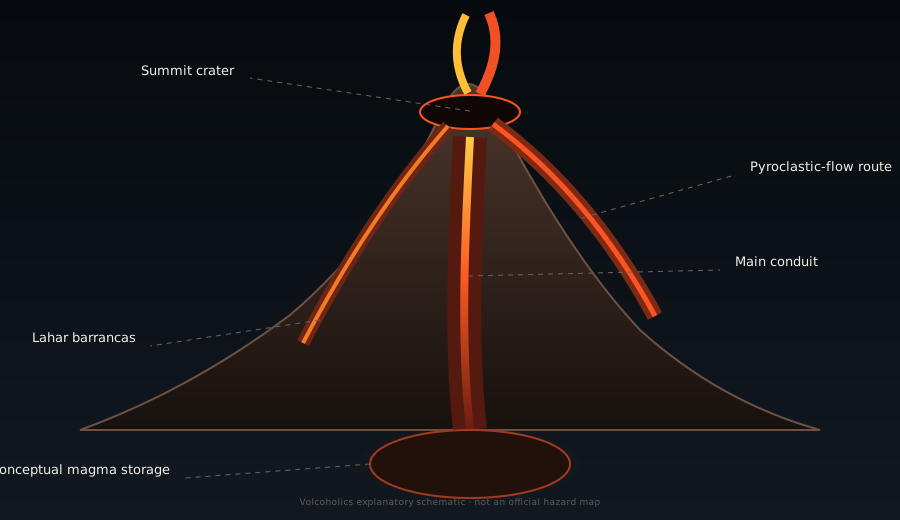
Magma and gas maintain a persistent pathway to the summit, allowing frequent explosions without a long sealed-pressure phase.
Fuego is frequently active and conditions can change quickly. View the Volcoholics volcano directory for the latest verified official position from INSIVUMEH and CONRED.
View latest Fuego status →One of the world's most persistently active volcanoes — where frequent summit explosions, steep ravines and intense tropical rainfall create a constantly changing, never fully predictable hazard landscape.
Fuego is not simply a volcano that occasionally erupts. It is a persistently open, continuously active system whose ordinary behaviour includes repeated explosions, ash columns, incandescent blocks and rock avalanches — often several times per hour.
Rising immediately south-west of the older Acatenango massif in Guatemala's Central American volcanic arc, Fuego is one of the most closely observed volcanoes in the western hemisphere. Its near-symmetrical cone is geologically young — repeatedly rebuilt by lava flows, scoria, ash and block-rich deposits over thousands of years — and it shows no sign of slowing. Since 1999, when persistent modern activity became established, Fuego has produced hundreds of explosive episodes of varying intensity, interspersed with stronger eruptive crises and, in June 2018, one of the most catastrophic volcanic events in Central America in decades.
The volcano's magma is basaltic-andesitic to andesitic in composition — fluid enough to feed lava flows and incandescent avalanches, yet sufficiently gas-rich to produce sudden, violent explosive bursts. This combination, set against the backdrop of steep slopes, deep ravines, dense surrounding population and one of the heaviest seasonal rainfall regimes in Central America, makes Fuego uniquely demanding to monitor and to live alongside.
Fuego commonly produces gas-and-ash emissions, weak-to-moderate explosions, incandescent material and periodic lava flows. Stronger phases can generate pyroclastic density currents, widespread ashfall and evacuations.
Check the latest verified status →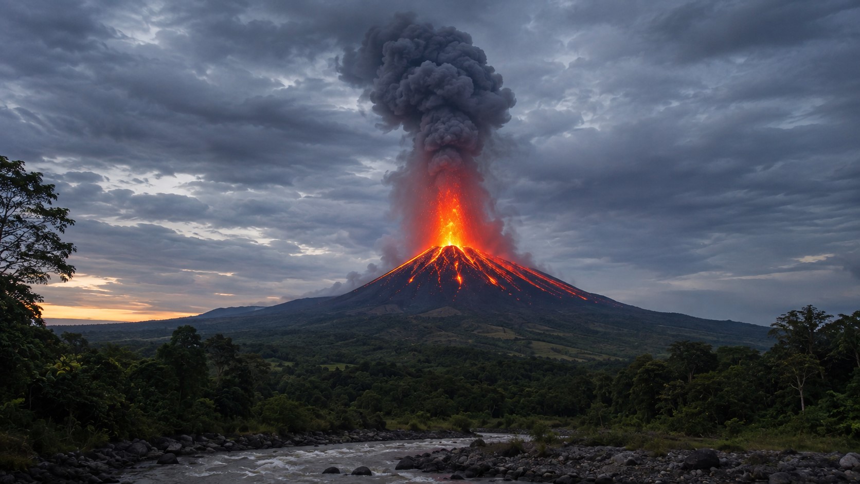
Fuego moves between ordinary persistent explosions, stronger eruptive phases and rare paroxysms. The 3–5 August 2026 episode has ended; the volcano has returned to its usual background pattern, but the system remains active and capable of rapid escalation.
Magma and gas maintain a persistent pathway to the summit, allowing frequent explosions without a long sealed-pressure phase.
Basaltic-andesitic magma is fluid enough for lava and avalanches, yet gas-rich enough to drive repeated explosive bursts.
Weak-to-moderate explosions, ash plumes and incandescent material are normal features of Fuego's long-lived eruptive state.
Explosion energy, ash height and material entering the barrancas can increase quickly, sometimes with little practical warning.
INSIVUMEH bulletins compress a fast-changing volcano into a handful of observations. Each number describes one part of the system; none should be read in isolation.
Deep ravines called barrancas cut every flank of Fuego's cone. They are not incidental features — they are the primary control on where volcanic material goes during every eruption, and therefore the primary determinant of which communities are at risk.
The barrancas were carved over thousands of years by a combination of volcanic activity and intense tropical rainfall. They are steep, narrow, deep-sided channels that concentrate pyroclastic avalanches, lava flows and lahars into specific corridors descending from the summit toward the surrounding lowlands. During eruptions, incandescent material enters the upper barrancas almost immediately as it descends the cone. During and after rainfall — which in Guatemala's rainy season can be intense and sustained — these same channels fill with lahars: destructive mixtures of volcanic debris, boulders and water that travel at high speed and can reach communities far from the volcano itself.
Fuego has been active throughout the Holocene and was known to pre-Columbian Mayan civilisations inhabiting the Guatemalan highlands. Colonial-era Spanish records describe eruptions from the 16th century onward, establishing Fuego as one of the most persistently documented volcanoes in the Americas. Its name — "fire" — reflects centuries of visible activity above the surrounding agricultural landscape.
A significant explosive episode produced widespread ashfall and pyroclastic flows around the volcano, demonstrating Fuego's capacity for activity well beyond its ordinary background level. The 1932 event is one of the most frequently cited 20th-century reference points in the volcano's historical record.
Strong explosive activity produced significant ashfall across a wide area of Guatemala and generated pyroclastic flows. The 1974 eruption is considered one of the more energetic events in Fuego's modern documented history and produced lava flows that reached considerable distances down the flanks.
Since 1999, Fuego has maintained a near-continuous state of eruptive activity — the pattern of repeated Vulcanian explosions, incandescent avalanches and periodic stronger phases that defines its current character. This sustained activity has produced hundreds of bulletin-level events, dozens of significant eruptive phases requiring evacuation, and continuous ash dispersal affecting communities and occasionally aviation across Guatemala and neighbouring countries.
A strong eruptive phase produced significant ash columns, incandescent material and pyroclastic flows that required the evacuation of thousands of residents from surrounding communities. The 2012 event reinforced the need for maintained evacuation infrastructure and rapid-response capacity around the volcano.
On the afternoon of 3 June 2018, Fuego entered a rapid and extreme eruptive escalation. Within a short period, the activity intensified to a level far beyond anything observed in the modern monitoring era. Powerful pyroclastic density currents — travelling at high speed and carrying temperatures capable of incinerating everything in their path — descended the southern flank through Barranca El Jute and several adjacent ravines.
The currents overwhelmed the communities of San Miguel Los Lotes, El Rodeo and surrounding areas with almost no practical warning time. The official death toll reached at least 215 confirmed fatalities; many more remain missing and are presumed dead. Hundreds of homes were destroyed or buried. The disaster was the deadliest volcanic event in Guatemala since the 1902 Santa María eruption.
The 2018 event exposed critical gaps in early warning, evacuation route planning and the public communication of pyroclastic current hazard at a persistently active volcano. It fundamentally reshaped emergency planning around Fuego and prompted international scientific review of rapid-escalation scenarios at similar open-conduit systems worldwide.
Since 2018, Fuego has continued its persistent explosive behaviour with multiple significant eruptive phases requiring evacuations. INSIVUMEH and CONRED have strengthened monitoring, early warning and public communication capacity, while the barrancas remain active lahar corridors during every rainy season.
Fuego entered a major eruptive phase on 3 August, generating pyroclastic density currents, sustained ash emission and widespread disruption. Preventive evacuations and shelters supported roughly 1,680 people during the response. After about 50 hours, INSIVUMEH reported that the intense phase had ended. The episode remains an important case study in rapid escalation, evacuation and the remobilisation of fresh ash into lahars during rainfall.

Watch live volcano coverage and follow new activity as it develops. Volcoholics presents the visual story and monitoring context; INSIVUMEH and CONRED remain the official authorities for scientific interpretation and public-safety decisions.
Watch Volcoholics on YouTube ↗Fuego's most lethal hazard: fast, intensely hot mixtures of gas, ash and rock channelled through the barrancas, sometimes with very little warning.
Persistent explosions can affect nearby communities, crops and roads; stronger phases can spread ash much farther and disrupt aviation.
Rain remobilises loose ash, blocks and sediment into destructive flows. The hazard can remain high after the eruptive peak has passed.
Explosions throw bombs and blocks around the summit and upper flanks, making the crater area and high cone unsafe.

INSIVUMEH monitors the physical volcano; CONRED turns that scientific information into public-safety action. The system must watch both the summit and the drainage network because Fuego's danger can shift rapidly from ash and explosions to pyroclastic currents or rain-triggered lahars.
Communities around Fuego live with fertile volcanic soils, farming, tourism and family ties that cannot be reduced to a hazard map. Risk management therefore depends on trusted local communication, clear evacuation routes, shelters and practical knowledge of the barrancas.
The goal is not to portray residents as passive victims of an unpredictable mountain. It is to understand how official science, community memory and coordinated response work together during a rapid escalation.
Reality: weak explosions are part of Fuego's background state, but the system can escalate rapidly into pyroclastic-current activity.
Reality: high plumes and favourable winds can carry ash tens of kilometres and affect roads, crops, aviation and larger cities.
Reality: fresh ash and debris can feed destructive lahars during later rainfall, long after summit activity has reduced.
Reality: risk on Acatenango also depends on Fuego's current activity, ash, pyroclastic-current reach and official access restrictions.
"Fuego is one of the world's most captivating active volcanoes — its near-constant explosions, glowing night-time avalanches and dramatic profile above the Guatemalan highlands are genuinely extraordinary. But its almost continuous activity creates a dangerous illusion of predictability. The events of 3 June 2018 are the permanent reminder that 'normal' and 'harmless' are not the same thing at Fuego, and that the line between them can be crossed faster than anyone can respond."
This editorial summary reflects the scientific information above. It does not replace official monitoring, access restrictions or public-safety guidance from INSIVUMEH, CONRED and local authorities. Always check official sources before visiting the Fuego area.
Yes — Fuego has maintained persistent eruptive activity since at least 1999. Some level of explosive activity, degassing or incandescent avalanche output is almost always occurring. What changes is the intensity — from background Vulcanian explosions several times per hour, through stronger eruptive phases requiring evacuation, to rare but catastrophic paroxysmal events like June 2018.
During ordinary persistent activity, INSIVUMEH may record several weak-to-moderate explosions per hour. The rate can change substantially during stronger eruptive phases, so current official bulletins should always take priority over any typical figure.
Climbing to Fuego's active crater is extremely dangerous and subject to official restrictions — it is not a route that can be safely completed. The standard experience for visitors is to climb adjacent Acatenango (3,976 m), which provides spectacular views of Fuego's eruptions from a relatively safe distance. Even on Acatenango, the latest official activity and access guidance should be checked before departure.
The 3 June 2018 event involved an extreme and rapid escalation to a level far beyond Fuego's ordinary behaviour. Pyroclastic density currents descended the southern flank at high speed through populated ravines, giving communities almost no practical warning or escape time. At least 215 people died and many more remain missing. The disaster exposed critical weaknesses in early warning, evacuation planning and public communication of pyroclastic hazard at a persistently active volcano.
Yes. Guatemala City is roughly 40 km north-east of Fuego. Whether ash reaches the capital depends on plume height, wind direction and duration of activity. Significant eruptive phases have deposited measurable ash in the capital on multiple occasions. Aviation in and out of La Aurora International Airport can be disrupted by ash during stronger events.
Lahars are destructive flows of volcanic debris, ash, boulders and water that travel through Fuego's barrancas. They are triggered when rainfall — which in Guatemala's rainy season (May–October) can be intense — saturates loose volcanic deposits on the flanks. Critically, lahars can occur when summit explosive activity is relatively weak, simply because old deposits remain available for remobilisation. They extend the hazard far beyond the eruption itself.
Barrancas are the deep ravines that cut every flank of Fuego's cone. They control where volcanic material goes — during eruptions, incandescent avalanches and pyroclastic currents travel down these channels; during and after rainfall, lahars use the same paths. The specific barrancas most relevant to hazard management are Seca, Ceniza, Las Lajas, Honda and El Jute, each draining toward different surrounding communities.
INSIVUMEH (Instituto Nacional de Sismología, Vulcanología, Meteorología e Hidrología) is the official scientific monitoring agency. CONRED (Coordinadora Nacional para la Reducción de Desastres) coordinates public safety, evacuations and emergency response. Both publish information in Spanish; INSIVUMEH bulletins are the primary scientific source for current activity.
Not during the August 2026 eruptive episode. CONRED has restricted access to both Fuego and Acatenango while intense activity and pyroclastic-current hazards continue. Follow official INSIVUMEH and CONRED instructions and do not rely on tour availability, social media footage or conditions observed earlier in the day.
They are two separate volcanoes sharing a common flank. Acatenango (3,976 m) is significantly older and currently dormant — it is the standard trek destination and viewing platform for Fuego. Fuego (3,763 m) is the younger, persistently active cone to the south-west. Despite appearing as one twin-volcano massif from a distance, they have distinct volcanic histories and entirely different current behaviour.
Fuego is consistently ranked among the world's most active volcanoes by eruption frequency. Its combination of persistent Vulcanian explosions, open-conduit behaviour, steep terrain and populated surroundings places it in a small group of volcanoes — alongside Stromboli, Etna and Kīlauea — that are almost never truly quiet. Unlike those volcanoes, Fuego's intense tropical rainfall adds a persistent secondary hazard (lahars) that remains active even during quieter eruptive phases.
INSIVUMEH publishes official bulletins at insivumeh.gob.gt — multiple times daily during active periods. CONRED publishes public safety and evacuation information at conred.gob.gt. Both are in Spanish. These are the only authoritative sources for Fuego's current status and should always be consulted before any visit to the area.
This evergreen profile uses INSIVUMEH bulletins, CONRED public-safety information and authoritative scientific literature as its factual basis. Historical eruptions, monitoring methods, hazards and geological context are presented separately from today's operational status, which is maintained in the Volcoholics volcano directory. No news outlet, social-media post or aggregator is used as a primary factual source.