Alert levels and monitoring conditions can change. View the Volcoholics volcano directory for the latest verified official position from INGV-OE and Italian Civil Protection.
View latest status →Etna
A vast, continually evolving volcanic system — where lava fountains, crater collapses, ash clouds and centuries of human life share the same mountain.
Europe's restless giant
Etna is not defined by one crater or one eruption style. It is one of the most studied volcanoes on Earth — a complex, permanently active system whose summit, flanks and internal plumbing are in a state of continual change.
Rising above the eastern coast of Sicily, Etna covers approximately 1,250 km² and reaches roughly 3,320–3,400 metres above sea level — a figure that shifts as summit eruptions build new material and collapses remove it. It is Europe's largest active volcano by volume and, across its 500,000-year history, one of the longest-documented volcanic systems anywhere on the planet.
Most of its output is basaltic, which allows magma to produce lava flows, lava fountains and Strombolian explosions rather than the catastrophic explosive columns of more silica-rich volcanoes. But basaltic does not mean predictable. Etna can shift rapidly between quiet summit degassing, sustained effusive phases, energetic fountain episodes, and the short, violent bursts known as paroxysms — sometimes within hours.
Its significance is also deeply human. Farms, vineyards, towns, roads, ski lifts and one of Sicily's major airports share its slopes and surroundings. Communities have adapted to centuries of activity, but lava, ash, earthquakes and rapidly evolving summit conditions remain an active part of life on the volcano's flanks.
Etna at a glance
Active, variable and closely watched
This profile explains Etna's geology, eruption styles, hazards and monitoring. For the latest alert level, aviation information and operational guidance, use the Volcoholics volcano directory and follow INGV-OE and Italian Civil Protection.
View latest status →How it works

The four summit craters
Etna's summit is a cluster of four distinct crater areas — not one central opening — each with its own history, character and current activity level.
The North-East Crater formed in 1911 and was for decades the highest point on the volcano. It is associated with sustained Strombolian activity and major paroxysmal fountain sequences, and often dominates infrasonic and tremor records during active phases.
Voragine — "the chasm" — is the oldest of the four, active since at least the 16th century. It is capable of the most violent behaviour: the December 2015 paroxysmal sequence from Voragine sent eruptive columns to 15 km above sea level, the highest from Etna in decades.
Bocca Nuova formed in 1968 as a collapse pit adjacent to Voragine. It comprises two interconnected pit craters and is a persistent source of degassing and occasional ash emissions. It and Voragine are sometimes grouped as the central craters.
The South-East Crater complex — born from an eruptive fissure in 1971 — is now the youngest, largest and most active summit area. It has been the primary source of paroxysmal lava fountain episodes since the 1990s, producing more than 50 in 2021 alone, and growing substantially with each eruptive cycle.
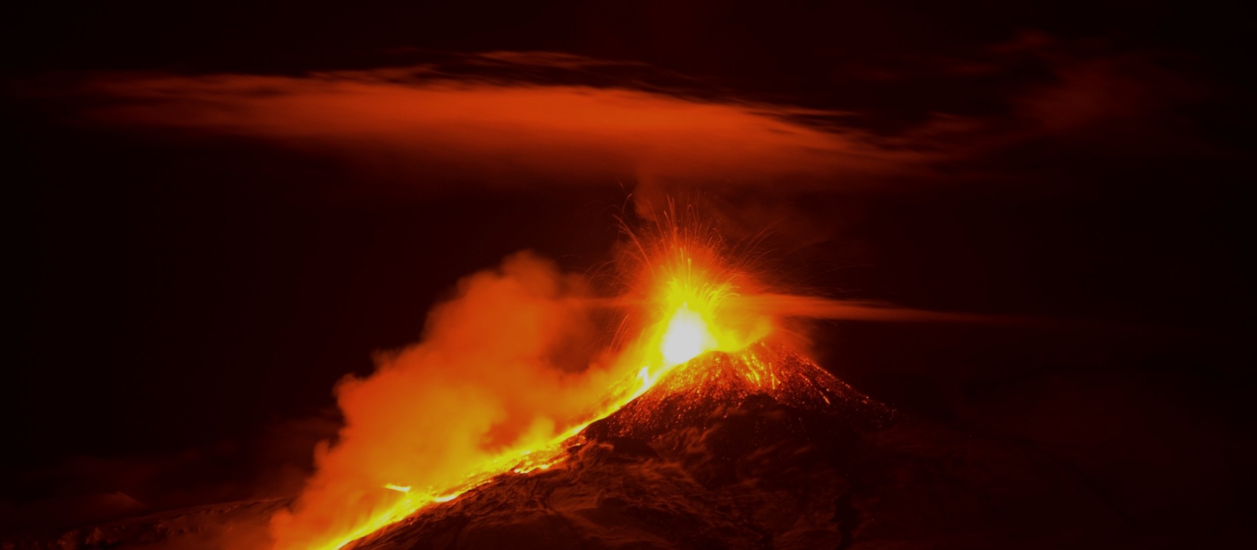
Fire and snow
Few volcanoes display contrast as dramatically as Etna: glowing fountains rising above snowfields, black lava cutting through white slopes, and ski lifts operating within sight of active craters.
Etna's elevation produces heavy winter snowfall while magma remains active a few kilometres below. Snow and ice can melt around hot deposits, conceal unstable terrain and complicate emergency access. The visual effect is extraordinary, but it is also part of the hazard environment — meltwater interacting with magma can generate phreatomagmatic explosions more violent than dry eruptions of the same scale.
This duality extends to the human landscape. The same fertile volcanic soils that support world-class viticulture on the lower flanks are the product of thousands of years of ash and lava deposits. The mountain gives and threatens at the same time — something the communities around Etna have understood for as long as they have been here.
Why Etna changes so often
Etna’s behaviour shifts because its magma supply, branching plumbing system, summit morphology and unstable eastern flank are all changing at the same time.
Magma can rise through the central summit conduits or force open inclined dikes toward the flanks. Pressure changes may migrate activity from one summit crater to another, while repeated eruptions build new cones, collapse crater rims and alter the pathways available to the next batch of magma.
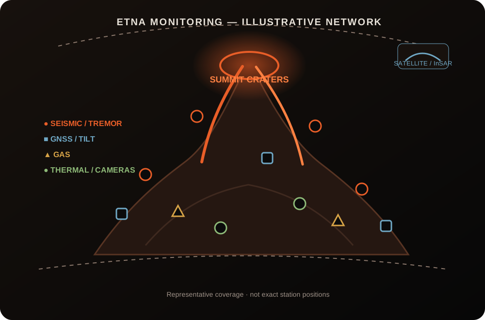
One mountain, many instruments
INGV’s Osservatorio Etneo monitors Etna as a connected system. Seismicity, tremor, infrasound, gas, deformation, cameras and satellites each describe a different part of the volcano; none is treated as a standalone eruption forecast.
Eruptions through history
Origins beneath the sea
Etna's earliest phase produced tholeiitic basalts through submarine fissural eruptions. As the edifice grew and breached sea level, the eruption style shifted and magma composition began its long evolution toward the alkali basalts erupted today.
First recorded eruptions
INGV's DANTE database — the most comprehensive record of Etna's eruptive history — lists documented eruptions dating to at least 1500 BCE. Greek and Roman writers recorded later events: Pindar wrote of the volcano, and Empedocles of Akragas was said to have studied it directly.
The most destructive eruption in recorded history
A catastrophic SW-flank fissure eruption created the Monti Rossi cinder cones and sent lava flows more than 15 km downslope. Flows breached the walls of Catania, destroyed villages, and reached the Ionian Sea across more than 40 km². One of the earliest attempts to divert lava artificially was made during this event.
Mascali destroyed
A flank eruption on the northern slopes overwhelmed the town of Mascali, destroying it entirely — a stark demonstration of the threat posed when magma breaks out far below the summit, giving little warning to downslope communities.
The longest flank eruption of the 20th century
Over 473 days, lava advanced toward Zafferana Etnea, prompting one of the most ambitious lava-diversion operations in European history — including the use of explosives to breach a lava tube. The flows stopped just short of the town.
Flank eruptions and infrastructure damage
Two eruptions in quick succession damaged ski and tourist facilities, produced widespread ash affecting Catania airport, and opened simultaneous vents on both north and south flanks during the 2002–03 event.
Voragine's record-breaking paroxysms
Intense activity from Voragine generated eruptive columns reaching 15 km above sea level — the highest from Etna in decades — with lava fountains visible across much of eastern Sicily and ash reaching the Greek islands.
Fifty paroxysms in a single year
The South-East Crater complex entered an extraordinary phase of repeated short-duration paroxysmal episodes — more than 50 in 2021 alone — building the crater complex substantially and repeatedly disrupting Catania airport with ashfall.
Renewed summit growth and shifting vents
Voragine grew further during intense 2024 activity, at times reclaiming the title of highest point on the volcano. Through 2025 and the first half of 2026, Etna continued to alternate between summit explosions, ash emissions and effusive activity from high-elevation vents.
Voragine paroxysm and Valle del Leone lava flow
Activity at Voragine intensified twice on 30 July, producing sustained Strombolian explosions, lava fountaining and ash clouds reaching about 7 km above sea level. A small pyroclastic flow descended the crater flank, while a new fissure opened at roughly 2,700 m in the upper Valle del Leone. The lava flow remained active into 31 July and ended during the night of 1–2 August after travelling about 2.9 km.
The hazards that matter most
Lava flows
Summit flows usually remain high on the volcano, but flank eruptions can open much lower and threaten roads, buildings and communities with less warning.
Ashfall
Paroxysms can spread ash and lapilli across eastern Sicily, affect agriculture and repeatedly disrupt Catania Fontanarossa Airport.
Ballistic ejecta
Blocks and bombs close to active craters make summit access hazardous even when wider communities face little direct threat.
Aviation impacts
Ash clouds can force airspace restrictions, diversions and airport closures. INGV issues VONA notices when aviation conditions require them.
Etna myths, separated from the science
Most summit activity remains far above the city. Lower flank eruptions are the scenarios that create the greatest direct lava-flow concern.
They are spectacular, but ash, ballistic ejecta, flank openings and earthquakes can be more important for public safety.
Its history includes numerous flank eruptions from fissures and vents well below the summit complex.
Etna can produce ash during relatively brief summit episodes. Scale, height, duration and official observations provide the necessary context.
Restless does not mean unpredictable
"Etna never feels finished. Its craters rise, collapse and rebuild; lava redraws the slopes; snow covers yesterday's deposits; and communities continue life beneath it. No other volcano in Europe shows the Earth's capacity for creation and disruption with such regularity, such accessibility, or such beauty."
This editorial summary reflects the scientific information presented above. It does not replace official monitoring, access restrictions or public-safety guidance from INGV, Italian Civil Protection and local authorities. Always consult official sources before visiting the volcano.
Etna explained
Where can I find Etna's latest official status?
Use the Volcoholics volcano-status directory for the latest verified summary, then follow INGV's Osservatorio Etneo and Italian Civil Protection for authoritative scientific and operational updates.
Is Etna always erupting?
Etna is almost never truly quiet — some level of degassing, seismic activity or low-level summit explosions is typical background behaviour. What varies dramatically is intensity and style: from quiet fumarolic activity to major lava fountain episodes producing columns tens of kilometres high.
How high is Mount Etna?
Etna's summit elevation is not fixed. Paroxysmal eruptions build new material while collapses and erosion remove it. Recent measurements generally place the highest point at roughly 3,320–3,400 metres, but this changes after every significant eruptive episode. INGV surveys the summit morphology by drone after major events.
Why does Etna produce so much ash?
Explosive fragmentation during lava fountains and Strombolian activity sends ash and lapilli into prevailing winds, which regularly carry them across eastern Sicily and occasionally to the Italian mainland, the Balkans and North Africa. The scale of ash production is closely linked to magma supply rate and gas content during each episode.
Can lava reach towns?
Yes — and it has. Historic flank eruptions have destroyed entire settlements, including Mascali in 1928. Most modern activity remains high on the volcano, but a major unexpected flank eruption is considered the most serious threat to downslope communities. Lava diversion using earthworks and, historically, explosives has been attempted during threatening events.
What is a paroxysm?
A short, high-intensity summit episode involving rapid escalation to intense lava fountaining, a tall ash-and-gas column, and rapid tephra fallout over a wide area — often ending as abruptly as it began. Etna produced more than 50 paroxysmal episodes in 2021 alone, mostly from the South-East Crater complex.
Who monitors Etna?
INGV's Osservatorio Etneo (OE) in Catania operates the scientific monitoring networks — seismic, infrasound, GPS, InSAR, gas, thermal and visual. Italian Civil Protection manages alert levels and emergency coordination. INGV-OE publishes multiparametric weekly bulletins every Monday, and issues VONA notices to aviation authorities when significant ash occurs.
What is Valle del Bove?
A large horseshoe-shaped depression on Etna's eastern flank, several kilometres across, that exposes the volcano's internal layered structure and acts as a natural receptacle for lava flows erupting from the summit. Its presence has historically directed lava away from the most populated western and southern flanks.
What makes Etna scientifically unusual?
Etna's magma composition and location do not fit neatly into any of the three classical models for volcano formation — it is not a typical subduction volcano, hotspot or rift-zone system. A 2026 study proposed it may be the world's first known giant petit-spot volcano, fed by mantle pockets squeezed upward at ~80 km depth as the plate bends into the subduction zone. Its longevity, output and accessibility make it one of the most-studied volcanoes on Earth.
Can visitors climb Etna?
Access to higher elevations depends on volcanic activity, weather conditions and official restrictions. Guided ascents to the summit craters require authorised guides and may be suspended at any time. Lower-elevation areas and crater rim viewpoints are generally accessible, but visitors should always check current access conditions with official authorities before visiting.
Why does the summit height keep changing?
Each significant eruptive episode deposits new scoria, lava and ash at or near the summit craters, building them higher — while collapse events, heavy rain and erosion can remove material just as quickly. Voragine, the North-East Crater and the South-East Crater complex have each held the title of highest point on Etna at different times in recent years.
How is Mount Etna monitored?
INGV's Osservatorio Etneo uses seismic, deformation, gas, thermal, satellite and visual observations to track changing summit and flank activity. Italian Civil Protection provides national alert-level and public-safety information.
Official science, made readable
This profile uses INGV publications, Italian Civil Protection information and authoritative eruption records as its only factual sources. Editorial passages explain the significance of what is observed while keeping official monitoring data and safety guidance clearly attributed and separate. No news outlet, social media or aggregator site is used as a factual source.