Why the ground rises
Pressure from fluids, gas and deeper volcanic processes can deform the rocks above the caldera and lift the surface around Pozzuoli.
Alert levels and monitoring conditions can change. View the Volcoholics volcano directory for the latest verified official position from INGV-OV and Italian Civil Protection.
View latest status →A wide volcanic system where earthquakes, ground uplift and gas emissions reveal a caldera that has never truly gone quiet.
Campi Flegrei is not a single cone. It is a broad, partly submerged caldera west of Naples, filled with towns, bays, lakes, vents and the remains of many past eruptions.
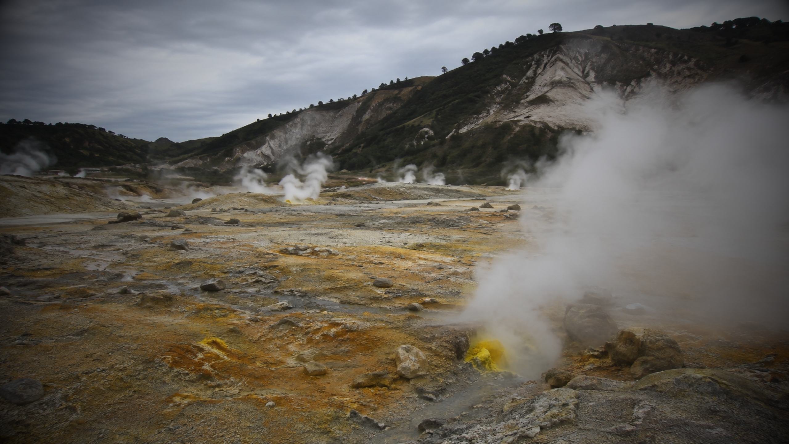
The volcanic field covers roughly 130 square kilometres, including a substantial offshore portion. Its landscape contains more than two dozen eruptive centres — maars, tuff rings, cones and domes — rather than one permanent central vent. Solfatara, Pisciarelli, Agnano, Astroni, Lake Averno and Monte Nuovo are all pieces of the same larger system.
That geography matters. A future eruption would not necessarily begin where the last one occurred, and scientists cannot simply watch a single crater. Monitoring networks therefore track deformation, earthquakes, gas chemistry, temperature and gravity across the caldera.
Pozzuoli and the western districts of Naples sit inside or along the margins of the volcanic system.
The modern coastline is not fixed. Ancient Roman structures at Pozzuoli record repeated rises and falls of the land, while submerged and uplifted archaeological remains preserve centuries of bradyseismic movement. This long history explains why ground deformation is both scientifically important and culturally visible.
Campi Flegrei’s density of population makes risk fundamentally different from that at a remote volcano. Even moderate earthquakes can affect vulnerable buildings, while any future eruptive crisis would require decisions across a complex urban region.
The land around Pozzuoli repeatedly rises and falls as pressure changes beneath the caldera. It is a measurable process — not an eruption countdown.
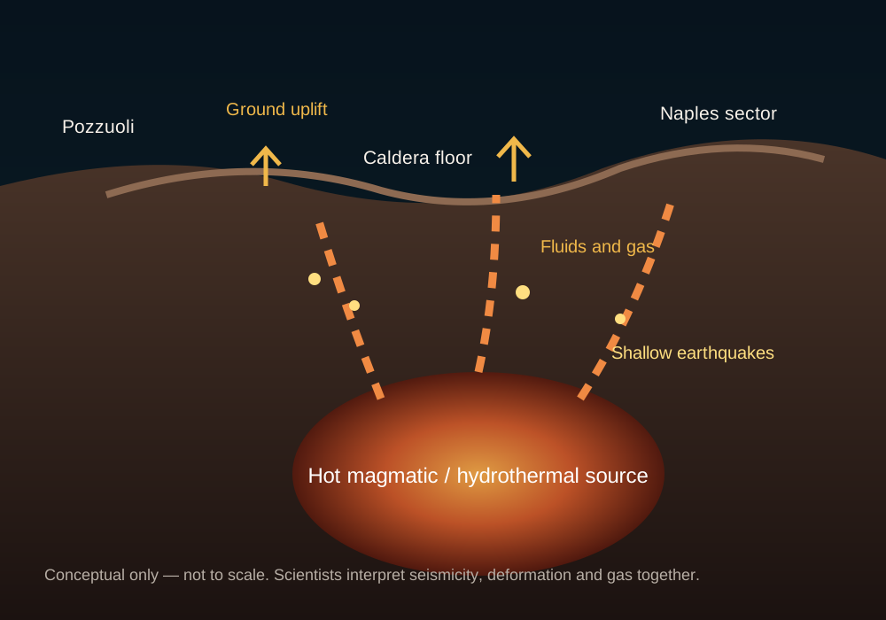
Pressure from fluids, gas and deeper volcanic processes can deform the rocks above the caldera and lift the surface around Pozzuoli.
As stress changes, shallow rocks fracture. Swarms can be strongly felt, but their meaning depends on depth, location, energy and the wider monitoring picture.
Bradyseism records changing pressure. It does not provide an eruption date, and unrest can continue for years without magma reaching the surface.
No individual earthquake, gas reading or uplift measurement can diagnose what happens next. INGV evaluates how multiple signals change together through time.
This profile explains the science behind Campi Flegrei. For the latest alert level and operational guidance, use the Volcoholics status directory and follow INGV-OV and Italian Civil Protection.
View latest status →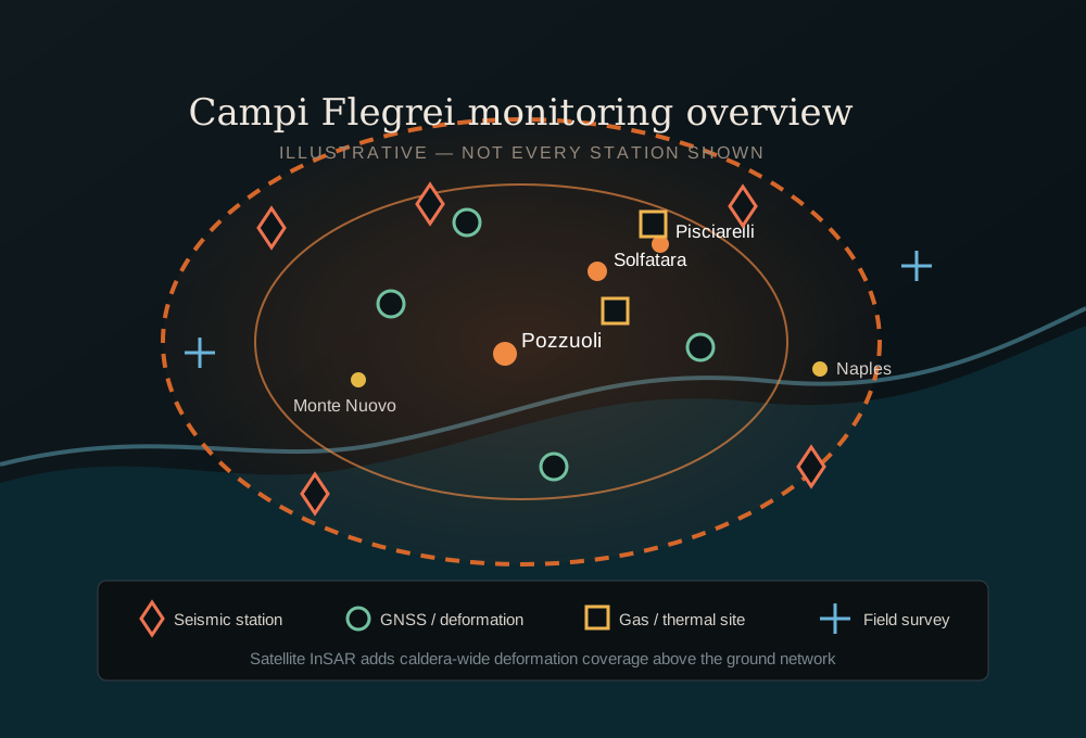
INGV’s Vesuvius Observatory combines dense ground networks with satellite observations and repeated field measurements. The goal is to identify meaningful change across the caldera rather than react to one isolated signal.
Diagram is illustrative; station symbols show monitoring methods and key areas, not every instrument location.
The largest known eruption in the system’s history generated widespread pyroclastic currents and deposits across much of Campania.
Another major caldera-forming eruption reshaped the volcanic field and produced extensive yellow-tuff deposits used throughout Naples.
Activity formed craters, maars, tuff rings and cones at different locations within the caldera.
The only eruption in historical times began on 29 September after intense earthquakes and dramatic coastal uplift, building a new cone in only days.
Rapid uplift and intense seismicity forced evacuations in Pozzuoli and became a defining episode in modern Campi Flegrei monitoring and planning.
Episodes of uplift, seismic swarms and hydrothermal change have driven major expansion of monitoring and civil-protection planning.
Risk is not limited to a future eruption. Earthquakes, deformation and gas can create serious local impacts during prolonged periods of unrest.
Strongly felt events can damage vulnerable buildings and repeatedly disrupt daily life even without an eruption.
Uplift and repeated movement can strain roads, ports, utilities, buildings and underground infrastructure.
CO₂ can collect in low or enclosed spaces, while fumarolic areas present direct local hazards.
A future explosive eruption could bring ashfall and dangerous pyroclastic currents, with impacts shaped by vent location and wind.
Shallow earthquakes can result from changing stress and hydrothermal processes. Scientists interpret their location, depth and evolution alongside deformation and gas data.
Uplift confirms pressurisation and unrest, but similar crises have occurred without eruption. It is evidence to assess, not a countdown clock.
Preparedness covers a range of credible scenarios. Unrest alone does not establish the timing, location or scale of a future eruption.
Volcanoes do not erupt on fixed schedules. Past intervals cannot be used to calculate a deadline for the next event.
Campi Flegrei demonstrates why volcanic unrest must be interpreted through the full multiparameter picture. Earthquakes, uplift and gas changes are important evidence, but no single signal can provide an eruption date. The responsible approach is to follow INGV science and the operational guidance of Italian Civil Protection.
Use the Volcoholics volcano-status directory for the latest verified summary, then follow INGV’s Vesuvius Observatory and Italian Civil Protection for official scientific and operational updates.
Bradyseism is slow ground uplift or subsidence associated with pressure changes beneath a caldera. At Campi Flegrei it is closely linked with shallow seismicity and hydrothermal processes.
No. Uplift confirms changing pressure beneath the caldera, but similar episodes have occurred without eruption. Scientists interpret deformation alongside earthquakes, gas chemistry, temperature and other measurements.
The term is informal and often sensationalised. Campi Flegrei has produced very large caldera-forming eruptions, but many of its eruptions were much smaller. A future eruption would not automatically repeat the largest event.
Very large eruptions are part of its geological history, but past scale alone cannot predict the next event. Monitoring and planning consider a range of credible scenarios rather than assuming the most extreme outcome.
INGV’s Vesuvius Observatory provides scientific monitoring, while the Italian Civil Protection Department and local authorities provide operational guidance and emergency information.
This profile prioritises INGV, the Vesuvius Observatory and the Italian Civil Protection Department. Stable geological context is cross-checked against official INGV resources and peer-reviewed research.