April 2026 has produced one of the most relentlessly active fortnights in recent meteorological memory. Two simultaneous tropical cyclones — one reaching Category 5 with gusts near 300 km/h — tore through the South Pacific. Days later, a multi-day tornado outbreak raked four US states across four evenings. Across Africa, a deepening paradox of simultaneous flood and drought threatens food security for tens of millions. And Easter in Britain was anything but quiet.
Two severe tropical cyclones — Maila (Cat. 5) and Vaianu (Cat. 3) — were active simultaneously in the South Pacific during the first week of April, captured in the same satellite frame. Maila stalled over the Solomon Sea at peak intensity for several days, prolonging devastation across Papua New Guinea and the Solomon Islands. At least 11 people died. More than 20,000 needed immediate assistance.
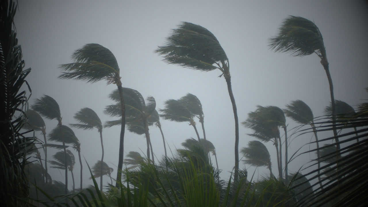
Twin Cyclones Maila & Vaianu — An Unprecedented Double Strike
The first week of April produced something meteorologists rarely see: two significant tropical cyclones active simultaneously in the South Pacific, visible in the same satellite frame — Maila churning in the Solomon Sea to the west, Vaianu spiralling near Fiji to the east. Both systems affected populated island communities at the same time, stretching the response capacity of meteorological agencies, emergency services and aid organisations across multiple nations.
🌀 Tropical Cyclone Maila Category 5 · Peak 8 April
Maila formed as Tropical Low 37U on 2 April between Papua New Guinea and the Solomon Islands — and carries the distinction of being the first tropical cyclone named by TCWC Port Moresby since Cyclone Guba in 2007, nearly two decades without a local naming event. It intensified rapidly, reaching Category 3 within three days of formation with sustained winds of 130 km/h and gusts to 185 km/h already battering the Solomon Islands' Western Province. By 8 April it had peaked at Category 5.
What made Maila so devastating was not only its intensity but its near-stationary behaviour at the height of its power. Trapped between competing pressure ridges, the system stalled over the Solomon Sea for several days with almost no forward motion — prolonging communities' exposure to storm surge, catastrophic swells and torrential rain far beyond what a faster-moving storm would have produced. Eight people were killed in a single night-time landslide at Asiko Village in Central Bougainville. Roads and bridges were destroyed across multiple PNG provinces, blocking food supply routes and hampering aid workers. Australia pledged financial assistance to both nations.
🌀 Tropical Cyclone Vaianu Category 3 · 5–12 April
Running concurrently with Maila, Vaianu tracked through the waters between Fiji and Vanuatu as a Category 3 severe tropical cyclone from 5–8 April, peaking with maximum sustained winds of around 185 km/h. Although the Fiji Meteorological Service confirmed its centre would remain offshore, the associated trough produced widespread flooding across Viti Levu and Vanua Levu — forcing road closures throughout the Western and Central divisions, university and school shutdowns, flight cancellations, and the relocation of a Suva health centre to the Vodafone Arena. Non-essential government workers were stood down nationwide.
Vaianu's story did not end at Fiji. As it tracked south into increasing wind shear it transitioned to an extratropical system and struck New Zealand's North Island on 11–12 April, where MetService NZ had issued an early Severe Weather Watch for damaging winds, heavy rain and hazardous coastal conditions. The storm's long arc — from tropical cyclone near Fiji to extratropical gale over New Zealand — is a reminder of how Pacific systems rarely confine their impacts to a single country.
US Midwest Tornado Outbreak 13–16 April · 4 States
With the South Pacific still recovering, a multi-day severe weather outbreak was building across the central United States. The Storm Prediction Center (SPC) issued Enhanced Risk outlooks on both 13 and 14 April as a series of low-pressure waves tracked along a persistent frontal boundary, repeatedly destabilising an increasingly volatile air mass across the Plains and Great Lakes.
The opening salvo on the evening of 13 April produced at least 14 preliminary tornado reports spanning Kansas, Minnesota, Iowa and Wisconsin. The most damaging event struck near Ottawa, Kansas, with field reports describing structural damage, snapped power poles and widespread outages. An EF2 cut through Miami County, Kansas, damaging around 100 structures near Hillsdale Lake. An EF1 south of Mound City destroyed a mobile home and injured two people. The atmosphere was carrying 2,500–3,000 J/kg of MLCAPE — an exceptionally unstable profile for April.
Activity resumed on 14 April across Iowa and Wisconsin, where a radar-confirmed tornado with a debris signature near Union Center destroyed a house on Raese Road. Hail reports ranged from golf-ball to baseball size — up to 2.75 inches in Floyd County, Iowa. The Weather Prediction Center warned of repeated storm redevelopment through at least 16 April, raising flash flooding concerns in areas receiving consecutive days of heavy rainfall.
📡 US severe season context
Forecasters had already flagged 2026 as a season where flash flooding and damaging straight-line winds may be more impactful than raw tornado numbers. Long-range outlooks from multiple centres suggest tornado counts may run near historical averages, but the atmosphere's capacity for repeated, organised severe weather days — as demonstrated this week — means the risk to life and property remains significant. The severe season is now firmly underway.
The Flood-Drought Paradox FEWS NET High Risk
While cyclones and tornadoes command headlines, a slower and in many ways more consequential story is playing out across two continents. The FEWS NET Global Weather Hazards report for 16–22 April — compiled from NOAA, USGS, USDA and NASA data — describes Africa sharply divided: flooding risk rated as high across Eastern Africa and Yemen, while drought and abnormal dryness are deepening simultaneously in Southern Africa, western Angola and Central Asia.
In East Africa, La Niña conditions — now transitioning toward ENSO-neutral — have driven above-average rainfall across Kenya, Uganda, Ethiopia, Somalia and Djibouti. Flooding and landslides have been reported in Ethiopia, Kenya, Zambia, Botswana, Malawi and Mozambique, with inundation continuing in the Sudd wetlands of northern South Sudan. The same ENSO pattern keeps flood risk elevated in Hispaniola and northern South America.
The contrast with Southern Africa could not be starker. Drought in western Angola, southern Madagascar and neighbouring nations reflects a poor rainy season running November through March — the critical growing window — with rainfall deficits exceeding 300 mm below average in the worst-affected areas. For communities without food buffer stocks, sustained deficits of this magnitude translate directly into crop failure. Food security agencies are watching closely.
Storm Dave Amber Warning · 4–5 April
Named on 2 April as a significant Atlantic low organised south-west of the British Isles, Storm Dave crossed the UK on Easter Saturday night into Easter Sunday morning — the fourth named storm of the 2025–26 season. Its worst impacts concentrated across Scotland, Northern Ireland, northern England and north Wales. An amber wind warning covered northern England, southern Scotland and north-west Wales from 7 pm on 4 April through to 3 am on Easter Sunday.
The peak gust of the entire storm was recorded at Capel Curig in Gwynedd: 93 mph — an Easter Saturday record for the site. Aberdaron saw 83 mph; Emley Moor in West Yorkshire and St Bees Head in Cumbria both logged 75 mph. The timing compounded the impact: pre-planned Easter engineering works on British railways, including a six-day closure on the London Euston corridor affecting 100,000 daily passengers, left the transport network with almost no recovery capacity. Caledonian MacBrayne warned of fleet shortages; Irish Ferries cancelled sailings; Dublin Airport lost departures; ScotRail imposed wind-speed restrictions. By Easter Monday, a post-storm ridge brought dry, briefly sunny conditions.
ENSO Transition & The 2026 Atlantic Season
Underpinning much of this fortnight's global activity is the ongoing shift in the El Niño-Southern Oscillation cycle. La Niña — which has driven enhanced rainfall across East Africa, the South Pacific and parts of South America, while suppressing it across Southern Africa — is now transitioning toward ENSO-neutral, with a potential El Niño developing by the peak of the 2026 Northern Hemisphere hurricane season.
Colorado State University's April forecast calls for a slightly below-normal Atlantic season: 13 named storms, 6 hurricanes and 2 major hurricanes, with an ACE index of around 90 units — approximately 75% of the long-term average. A robust El Niño driving above-average wind shear across the tropical Atlantic and Caribbean is cited as the key suppression mechanism. Tropical Storm Risk issued a similarly cautious outlook with 12 named storms. The University of Arizona struck a contrasting note with 20 named storms, drawing comparisons to conditions preceding the notably active 2023 season. The Atlantic season opens officially on 1 June 2026.
📡 What to watch next week
East Africa flood risk remains the most urgent ongoing story — heavy rainfall is forecast to continue across Kenya, Ethiopia, Somalia and Uganda through at least 22 April. US severe season — the frontal boundary responsible for this week's outbreak remains active; watch for further organised severe weather across the Plains and Midwest. Atlantic pre-season — NHC begins Eastern Pacific Tropical Weather Outlooks on 15 May; Atlantic watch starts 1 June. ENSO transition — the speed and strength of any El Niño development through May–June will be the dominant driver of the 2026 hurricane season outlook.